No edit summary Tag: rte-source |
mNo edit summary Tag: rte-source |
||
| Line 1: | Line 1: | ||
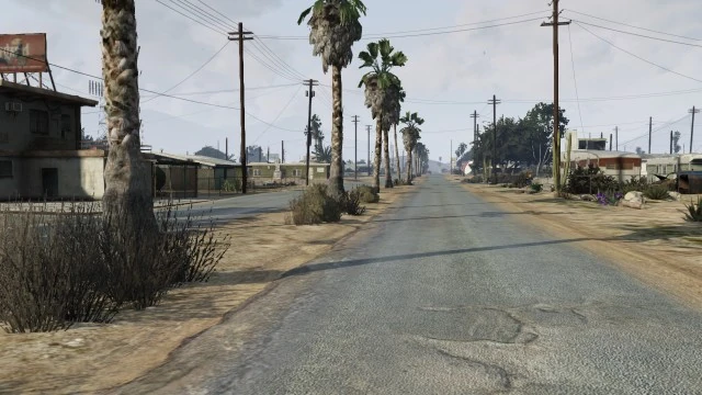
[[File:AlgoquinBlvd-GTAV.jpg|thumb|262px|Algonquin Boulevard]] |
[[File:AlgoquinBlvd-GTAV.jpg|thumb|262px|Algonquin Boulevard]] |
||
| − | '''Algonquin Boulevard''' is a divided two-lane boulevard that crosses the eastern part of [[Marina Drive]] and ends at [[Joshua Road]], running through the entirety of [[Sandy Shores]] in [[Blaine County]], [[San Andreas (HD Universe)|San Andreas]]. With much of Sandy Shores' former and remaining business community located along it, Algonquin Boulevard acts as a sort of main street to the town. |
+ | '''Algonquin Boulevard''' is a divided two-lane boulevard that crosses the eastern part of [[Marina Drive]] and ends at [[Joshua Road]], running through the entirety of [[Sandy Shores]] in [[Blaine County]], [[San Andreas (HD Universe)|San Andreas]]. With much of Sandy Shores' former and remaining business community located along it, Algonquin Boulevard acts as a sort of main street to the town. |
| − | This street is based on the real |
+ | This street is based on the real-life [https://www.google.com/maps/place/3797+Mountain+View+Dr/@33.4049966,-116.0414876,17z/data=!3m1!4b1!4m2!3m1!1s0x80da401dffdef6d5:0x75ac716c7063557b Mountain View Drive], in [https://en.wikipedia.org/wiki/Desert_Shores,_California%7C Desert Shores, CA]. |
==Businesses== |
==Businesses== |
||
| Line 22: | Line 22: | ||
==Trivia== |
==Trivia== |
||
*Algonquin Boulevard might take its name from the island of [[Algonquin]] in [[Liberty City (HD Universe)|Liberty City]]. |
*Algonquin Boulevard might take its name from the island of [[Algonquin]] in [[Liberty City (HD Universe)|Liberty City]]. |
||
| − | *The western end of Algonquin Boulevard is flanked by a number of demolished larger structures, implying a once-stable business district. |
+ | *The western end of Algonquin Boulevard is flanked by a number of demolished larger structures, implying a once-stable business district. |
| − | *A street-facing collapsed wall across from the motel bears a large stencil that reads, "SAVE THE SANDS". |
+ | *A street-facing collapsed wall across from the motel bears a large stencil that reads, "SAVE THE SANDS". |
[[de:Algonquin Boulevard]] |
[[de:Algonquin Boulevard]] |
||
Revision as of 05:32, 11 August 2015
Algonquin Boulevard
Algonquin Boulevard is a divided two-lane boulevard that crosses the eastern part of Marina Drive and ends at Joshua Road, running through the entirety of Sandy Shores in Blaine County, San Andreas. With much of Sandy Shores' former and remaining business community located along it, Algonquin Boulevard acts as a sort of main street to the town.
This street is based on the real-life Mountain View Drive, in Desert Shores, CA.
Businesses
- Marina Drive Liquor Mart
- BETHS DOG GROOMING
- Aunt Tammy's Hair Salon (abandoned)
- SHOOT F1RST Gun Store
- Seaton Sand's Automobile Services (abandoned)
- Sandy Shores Motel (abandoned)
- Liquor Ace
- Globe Oil Gas Station (abandoned)
- Roadside fruit stand
Gallery
")
Algonquin Boulevard marked in red on the map.
Trivia
- Algonquin Boulevard might take its name from the island of Algonquin in Liberty City.
- The western end of Algonquin Boulevard is flanked by a number of demolished larger structures, implying a once-stable business district.
- A street-facing collapsed wall across from the motel bears a large stencil that reads, "SAVE THE SANDS".